By Kammy Kern-Korot, Senior Conservationist
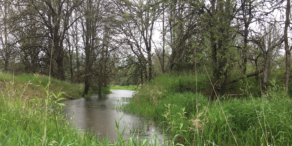
McCarthy Creek flows from NW Skyline Boulevard to Multnomah Channel across from Sauvie Island. This creek is unique to the area in that it is considered essential salmonid habitat, especially for coho and Chinook salmon. At the bottom of the watershedwatershed an area of land that channels rainfall, snowmelt, and runoff into a common body of water, such as a nearby lake or river. Multiple streams can be part of the same watershed area, such as the Tryon Creek Watershed which is fed by Oak Creek, Park Creek, Falling Creek, and others. is 121 acres of privately owned land – most of which is wetlands and within the 100-year floodplain – protected by a conservation easement. West Multnomah Soil & Water Conservation District (WMSWCD) manages the land on behalf of the landowner and the Natural Resource Conservation Service (NRCS), the federal easement holder. We continue to actively restore native wetland and oak habitat on this site.
This project site is important because it hosts an array of wildlife species and because it is large and adjacent to an even more significant wetland complex, called Burlington Bottoms. A primary ecological goal for both properties shared by the owning and managing partners is to return more natural flooding to portions of the site(s) and, in so doing, create additional aquatic habitat and displace the incredibly dominant and invasive reed canary grass with native wetland vegetation. Species that benefit from this restoration include fish, salamanders, frogs, beavers, waterfowl, herons, bald eagles, turtles, songbirds and insects. WMSWCD’s objectives also include restoring native vegetation along the creek, as well as the upland areas that don’t flood, to a diversity of native wildflowers, grasses, shrubs, and trees, most notably Oregon white oak.
The District secured funding in 2015 from NRCS to improve approximately 5 acres of riparianRiparian areas The land alongside a stream, creek, river, or floodplain (streamside) area and 3 acres of uplands. Since then, we’ve been treating invasive blackberry and reed canary grass, Canada thistle, and other weeds to restore riparian areasRiparian areas The land alongside a stream, creek, river, or floodplain and create Oregon white oak savanna and native plant “hedgerows” for pollinators and other wildlife. We took 2 years (2017 – early 2019) to plant 12,000 woody and herbaceous wetland plants along the creek and followed with upland plantings. We did this with the help of paid crews and area native plant nurseries. The total NRCS project is valued at $123,000, which includes $100,000 of NRCS funds and contributed District staff time.
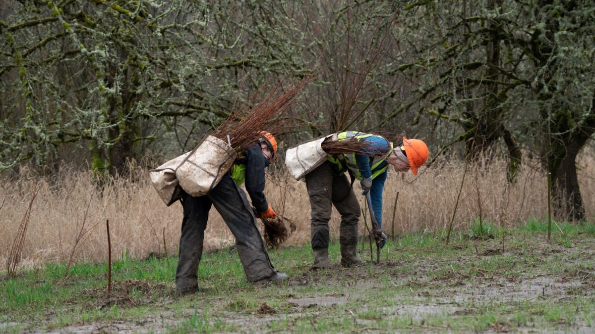
Photo by Pat Welle: Crews planting alder saplings and willow and dogwood cuttings.
We had the good fortune to find additional partners and funding that allowed us to embark on a new phase of restoration, which was begun in 2017 and completed in February 2020. In this project phase, we removed two culverts that were no longer needed, one of which impeded fish movement; added habitat features such as basking logs for turtles and structures to encourage and mimic beaver dams; and performed 4.8 acres of “marsh plain lowering” which greatly enhances wetland habitat. Invasive reed canary grass and more than 15,000 cubic yards of soil were scraped away to lower the surface elevation 2 to 3 feet in key wetland areas and to make the streambanks less steep. The areas lowered will now be inundated with more water and for longer periods than before, which provides better access and habitat for juvenile salmon and facilitates establishment of native wetland plants such as wapato, bulrush and bur-reed. The excavated soils were redistributed to cover invasive grass and replanted with native plants in both adjacent wetlands and the uplands.
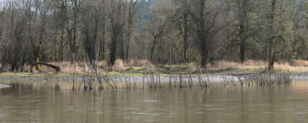
Photo by Pat Welle: A newly installed beaver dam analog, which is designed to saturate the site with more water and encourage beavers to create and maintain natural beaver dams, outcomes which better support native plant communities and make for healthier wetlands.
For this latest stage of restoration, we planted more than 8,000 new native trees, shrubs, and forbs (wildflowers), including over 30 species of forbs. We also seeded 100+ pounds of over 20 different species of native grasses and forbs in almost all areas of disturbed soil, both wetland and upland. Finally, we planted more sedges and rushes near the creek, to supplement earlier plantings there. More than $250,000 was invested in planting, maintenance, and wetland enhancement by Bonneville Power Administration via our partner Columbia River Estuary Study Taskforce, which facilitated the engineering and construction work.
The restoration work described here expands upon and connects to other restoration projects upstream, which are part of our Healthy Streams Program that aims to improve water quality and restore habitat along more of McCarthy Creek. The restored riparian forest keeps the water cool for fish, provides a corridor and connectivityConnectivity the degree to which patches of landscape are connected, either helping or impeding animal movement and other ecological processes like the flow of water or dispersal of seeds for wildlife to move uphill where air temperatures are cooler and where habitat is available, and it helps keep the climate cool for us humans, too!
After 10 years of District involvement, the landowner, our staff and board, and all of the project partners are thrilled with the progress we are seeing on the property. Native plant communities are getting established where we’ve done weed control, enhanced the water levels, and added new native plantings. While monitoring project progress on-site this spring, we observed beautiful blooms on the lupines and heal-all (prunella vulgaris), and strong presence of meadow barley and American sloughgrass, among the many species we seeded. We’re even seeing additional native plants, such as sneezeweed, beggar’s tick and native buttercups, already returning and expanding on their own. We look forward to more good things to come!
Visit our YouTube channel to see what the site looks like and to learn more about this project in a video featuring Senior Conservationist, Kammy Kern-Korot.
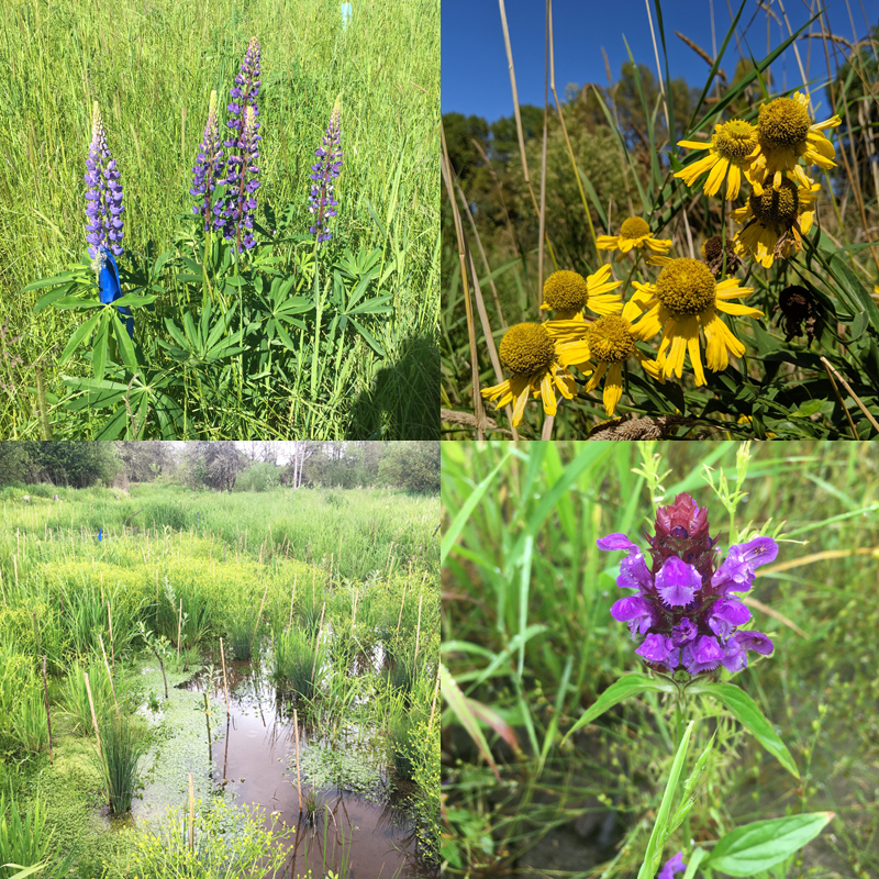
A few of the plants and flowers now growing on the restoration site:
