Sturgeon Lake Restoration Project update, June 2020

By Scott Gall, Rural Conservationist
It has been over a year since the completion of construction on the Sturgeon Lake Restoration Project. After a decade of partnership building, planning, fundraising, and engineering, and just over four months of construction over the summer and fall of 2018, led by Columbia River Estuary Study Task Force (CREST), the Dairy Creek channel reopened to tidal flow between the Columbia River and Sturgeon Lake on Sauvie Island in fall of 2018.
What started with a few shovelfuls of sand, resulted in the replacement of two failing culverts with a 96-foot channel-spanning bridge, restoration of a half mile of channel by removing 22,000 cubic yards of sand and sediment, installation of a debris boom at the mouth of the creek to prevent logs and other large objects from floating into the creek, and planting of over 40,000 native plants and shrubs across 15 projects sites that encompass the restoration project.
As the second full winter winds down, the complete effects of the tidal flow from the Columbia River on Dairy Creek and Sturgeon Lake are just starting to become evident. With the reopening of Dairy Creek, after 30 years of being blocked from tidal flow, the tide has once again become an influence on the channel and the lake, changing the flow direction of the creek on a daily basis during low Columbia River levels. Both of these conditions have had an obvious impact on the elevation and shape of the Dairy Creek channel.
Data on channel elevation – the elevation of the channel bottom relative to sea level – collected in 2017, 2018, and 2019 have shown that while the excavated channel has changed from the design configuration, it is simply moving towards an equilibrium. For the most part the average elevations and widths of the bottom of the channel have stayed relatively consistent. Meanwhile, along the stretch of creek between the bridge and the lake, a section not touched during construction, sediment has moved out, lowering the creek bottom 6 to 12 inches in most spots. This new, lower elevation is roughly the same as the excavated channel which would be expected in a tidal system that flows both directions.
Observation of changes within Sturgeon Lake have been harder to come by. The 3000 acres lake has few roads that reach the shoreline. This is a great feature for wildlife and quiet recreation but it makes monitoring the lake much more difficult. West Multnomah Soil & Water Conservation District and CREST are employing aerial drones to cover larger areas than would be possible by foot. But each drone flight only covers about 50 acres, so even these are just snapshots. Initial data has been relatively inconclusive, showing neither an increase nor decrease in sediment in the areas monitored. Our hope is to see a flushing out of lake sediment over time. We intend to take drone photos every year to see the incremental change over time, and our next flights are scheduled for this fall.
Work on vegetation restoration began a year before channel construction, and in these past three years, we have successfully helped reestablish 40,000 native plants throughout the 15 project areas, including Alder, maple, willow, snowberry, red-flowering currant and many other native trees and shrubs. With this focus on restoring native plants, grasses, and forbs, we are now seeing native plants covering 80-90% of the ground in most places along Dairy Creek. As a result, there is more evidence than ever of wildlife utilizing the site. Prominent wildlife trails have popped up all along Dairy Creek with evidence of tracks from otter, beaver, deer, skunk, and raccoon. Additionally this spring, a platform installed at the mouth of Dairy Creek is now home to its first pair of nesting osprey.
Next steps include installation of a fish monitoring device known as a Passive Integrated Transponder, or “PIT” tag array at the site of the new bridge, though this has been slowed in part due to the COVID-19 pandemic. The U.S. Army Corps of Engineers supplied $40,000 for equipment, and Oregon Department of Fish and Wildlife staff intend to install it this summer, hooking into a power supply we recently installed. Our goal is to have the array up and running by this winter.
At this time, all signs and data point to a very successful project. Staff at WMSWCD and CREST will continue to monitor Dairy Creek and Sturgeon Lake for years to come, and the lake appears to have a bright future.
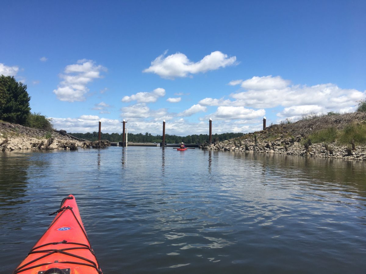
Facing the mouth of Dairy Creek and the Columbia River


